Monthly Archives: August 2023

Twelve arches and a brush with fame

With bad weather moving in Marce found us a quaint little harbor for a safe parkup to wait out the rain.

What it lacked as a proper harbor it made up for with a magnificent 1885 twelve arch railroad viaduct allowing rail service to Schull.

Now it’s part of a foot trail. Ballydehob is located at the confluence of the Bawnaknockane River and Roaringwater Bay, bounded by the Atlantic Ocean. Dodging rain drops I managed to grab some excellent takeout food without getting too wet and marveled at the remarkable number of sophisticated restaurants this cute little town has.

Ballydehob has managed gentrification via the usual route of artist colony, fine cuisine, and yachts.

The town certainly seems in an ebullient mood with festivals for every taste.

We heard that this weekend they’re having a BBQ, music, and traditional wooden boat festival so we’re definitely sticking around for that. Not the best weather for a BBQ but the good citizens of Ballydehob haven’t seemed to notice.

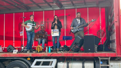
The wharf is really filling up with those well dressed citizenry. The band is kind of fun and the sausage baps are great.
We’ve even heard that sometimes Jeremy Irons sails up from Rocky Mannin Beg Island where his Kilcoe Castle overlooks Roaring Water Bay.

It’s time for the main event when one at a time the old traditional boats round the little island and arrive to deal with the Southern breeze setting the boats in towards the docks, rocks and concrete pier.

Some were more successful than others.

They need the pull of the sail to come into the little harbor but once in they need it doused in a hurry. Nothing happens in a hurry with these old boats.

I noticed one last traditional tanbark sail has come around the small protective island.

It dithered about, just off the harbor, shortening sail, then she headed in.

Everybody turned and watched. Every sailor’s nightmare.

I noticed Skipper change his mind and head over towards the concrete pier but with a little too much steam on, and having made this mistake a few times myself, I helped fend off just in time.

As soon as things calmed down I looked up and saw the skippers eyes. They were the deep brown eyes of Jeremy Irons.

To be honest his crew appreciated the help and it took some wrangling to get the dock lines sorted, but his locally made wooden boat, “Willing Lass” is simple and beautiful.

You never know what might happen wandering around Ireland.

Leave a Comment

Filed under Uncategorized

Fastnet!

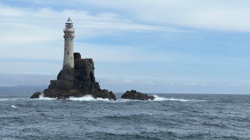
Fastnet Rock is legendary to anyone with an interest in the sea or sailing. It’s the southernmost point of Ireland lying way out in the Atlantic Ocean off the coast of County Cork.

My birthday was looming and after seeing Fastnet from Mizen Head we took the plunge and booked ourselves on a day trip to the Rock and Cape Clear Island. It’s a fitting way to spend my birthday.

The boat leaves from the little town of Schull and we arrived early enough to watch the local sailing school readying their boats for launch.

We were delighted to find our tour boat was half empty.

It took about 45 minutes to get to our first stop, Cape Clear Island, where we picked up additional tourists. We were now at capacity and headed for the Rock.

A lighthouse was first built on Fastnet after an American sailing packet was lost on a nearby island in thick fog in 1847. By 1854 the new lighthouse was signaling to ships at sea.

The original brick and cast iron structure proved to be too weak to withstand the ferocious gales common in these parts, despite attempts to shore up the base. By 1891 the powers that be also concluded that the signal from the lighthouse was too weak to signal ships arriving from across the Atlantic, and in 1899 construction of a new tower was begun. The stronger structure was built from dovetailed blocks of granite and entered into service in 1904. The beacon has a range of 27 nautical miles.

Here’s a little tech background for non-sailors. Every lighthouse has a unique sequence, described in abbreviated form on a nautical chart. It’s possible to be in range of more than one lighthouse at a time, so it’s important to know the pattern you’re seeing in the distance to be sure of which beacon it is. Here are some examples of lighthouse characteristics.

As a sailor I can tell you there’s nothing more reassuring when approaching a landfall as spying a signal exactly as described on the nautical chart, assuring you that you are where you think you are.

All of that aside, our first closeup view of Fastnet took our breath away.

We circled the Rock in both directions, giving everyone ample opportunity to get the money shots. It’s beautiful from every angle. And I promise you every one of these photos has had significant horizon correction; while it was an unusually calm day on the ocean, taking photos from the deck of a boat pitching in the Atlantic swell while dodging other tourists is no easy task.

Fastnet Light is the rounding mark for the legendary Fastnet Race, one of the three classic offshore yacht races, along with Sydney-Hobart and Newport-Bermuda, all about 625 nautical miles.

The 1979 race was hit with an unexpectedly severe storm that wreaked havoc on the 303 participating yachts and called in thousands of rescuers and emergency services. It was the single largest maritime rescue operation in peacetime. Nineteen people died, 75 boats capsized, five were lost and believed sunk.

There are plenty of videos about the event. Here’s a link to one of them.

When the captain decided we’d exhausted the photo possibilities he turned the boat back toward Cape Clear Island where we’ll have a couple of hours to explore an idyllic outpost of County Cork.

Not far from the harbor lies a memorial to the nineteen souls lost in the 1979 Fastnet Race. (More names in the side, for those counting.)

Beautiful Cape Clear Island swallowed up our fellow boat passengers and we spent a pleasant few hours exploring the country roads to the other side.

And then it was time for the return trip to the mainland. Escape Velocity’s absentminded navigator forgot to bring the tracker so if you’ve been following along on our track link, here’s the missing bit courtesy of Google maps.

We’ve had a delicious run of good weather but now it’s about to end.

3 Comments

Filed under Uncategorized

End of a perfect day

We picked our parkup for the night because it’s ten minutes away from tomorrow’s destination. It didn’t register until we arrived that we were visiting the 4000-year-old Altar Wedge Tomb. Not only is this a great example of the type, but we had it all to ourselves. We found that odd because the car park was full — we grabbed the last remaining spot — so we wondered where all the people were. A short meander down the road (truth be told, I was looking for ripe berries) revealed a small, protected beach. So that’s where everyone went.

We were content to bask in the sunshine and explore our little corner of the universe as afternoon slipped into evening.

I never get tired of gazing at the place where the sea meets the sky.

The days are getting shorter. We have so much more to see.

1 Comment

Filed under Uncategorized

Postcard perfect

Just a few miles from Mizen Head, on the north side of the peninsula, is Three Castles Head. Any mention of castles gets Jack to break out the hiking poles so off we went towards Dunlough Fort.

You can’t drive all the way there, and what you can drive is an unpaved track. A nearby farmer has set up a car park where you pay a couple of Euros to a young man who presumably watches your vehicle while you tramp up to the castle.

The name is confusing. The headland is called Three Castles, but there’s only one castle and it’s called a fort. The castle has three towers, hence the name Three Castles Head.

The path starts easy enough. Before long we were wheezing up a steep rocky trail that switched back and forth around hillocks and rock piles.

When we crested the hill we finally saw the castle and paused to catch our breath and take in the sweeping landscape.

It’s still a long way down. The distances are deceiving!

The castle is beautiful, as 13th century ruins go. We loved the many arches.

The real magic of Dunlough Castle is the setting, perched on the edge of a lake, with views out to the sea. It’s postcard perfect.

We thought it couldn’t get any better until we discovered a trail that leads further up the slope. And as we all know by now, Jack can’t resist getting to the top. So up we went.

What a stunning place! I know we say that a lot, but this is really one of our favorite castle ruins. Of course the brilliant weather helped.

We could have stayed for hours but it’s a long way home. We hiked back down to castle level and followed the path along the lake for a bit. Then it was time to start the steep trek down towards the sea and overland to Escape Velocity.

Believe it or not, this beautiful day isn’t over yet.

1 Comment

Filed under Uncategorized

Thrills and Chills

We pulled into Mizen Head car park unusually late for us so passing through the gate, I backed into the first spot I came to. It turns out it was the last empty spot. It pays to be lucky.

Bathed in brilliant sunshine we soon had Escape Velocity semi level and we were in the mood for a stroll. While I cinched up the Merrells Marce said, “Can you see that thing on the horizon?” Of course the bulb eventually switched on and it had to be the sailing icon of sailing icons. Fastnet!

I hadn’t expected to see it from here; it’s a good nine miles off but it’s unusually clear today and we’re really high up here on the cliffs. I sat and stared at it for a long time. Thrills and chills.

Mizen Head is a pay as you go proposition so after closing time the ticket gates, not to mention the gift shop, are closed and you’re not getting down to the rock. I didn’t mind. I am in my happy place, by the sea. When you think about it, it’s hard to believe the crazy path we’ve followed that has led us to this storied place. Yes, thrills and chills, especially when we came across this half buried propellor from a wreck off the headland.

Up here in these high latitudes it takes a while for a bright sunny day to soften into pastel azure shades of dusk.

The Fastnet lighthouse kept us company, every ten seconds, all night long.

We woke up at a more civilized hour, apparently, than most of the funseekers rapidly filling up the parking lot around us. It’s a long hike just to get to the entrance in the gift shop and we did not waste a moment of this glorious sunshine. The path starts as a steeply inclined exercise in keeping one’s downward momentum under control. I’m with Bill Bryson, struggling to not flail like George Chakiris as a nearly out of control Shark in West Side Story.

It’s not very elegant or satisfying but the views are magnificent.

This is Marce’s Giddyup look!

Mizen Head is the most southwestern point of Ireland and it’s the first — or last — sight of Europe for seafarers on this route. Like many headlands, and most here in Ireland, it’s rocky and forbidding and if you’re on a boat, you’ll give it a wide berth. Today the seas are calm but I can only imagine what it’s like in a blow.

The Head itself is almost an island so the first inspired bit of construction you come across is this graceful bridge spanning a deep canyon.

The old signal station is now part of the museum with displays on the history and significance of Mizen, and also the construction of the lighthouse on Fastnet Rock.

Marce in the radio shack
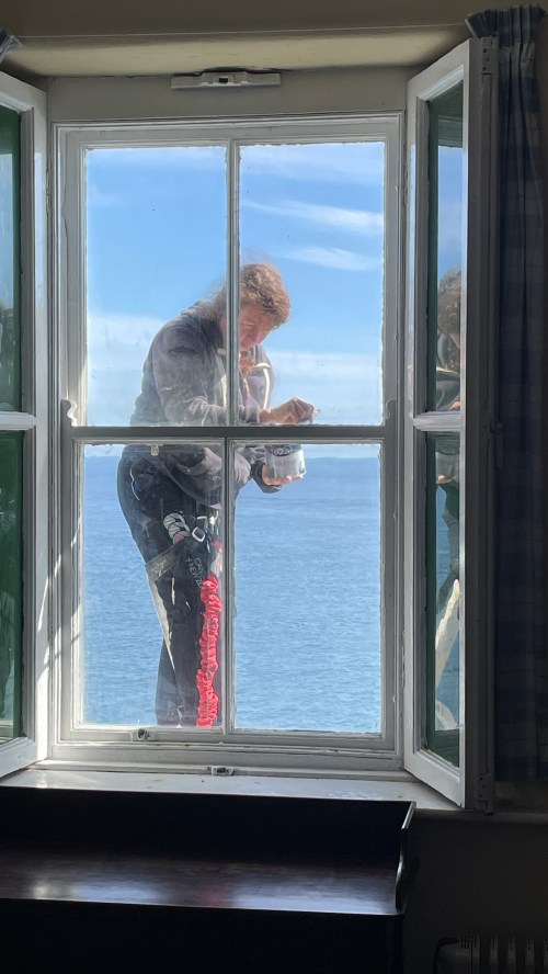
High altitude maintenance!
Next stop Boston!

What could be more perfect. A sloop, brilliant in the off-shore sun, full-and-by, working her way around Mizen Head, well off.

It’s impossible to capture the scale and majesty of this dramatic landscape.

Looking around I’m noticing a lot of weary faces and that’s when I recalled seeing a small sign warning of the 99 steps straight up to get back up to the gift shop. In other words, leave a little in the tank. I swear there would be fisticuffs if they dared put a bench seat on the way up.

Finally, as we grew closer I could just imagine how good those upholstered seats are going to feel. We both flopped down, looked up and there was Fastnet, a beacon even to a campervan.

Thrills and chills.

3 Comments

Filed under Uncategorized

Head for the pass

Slea Head Drive on the Dingle peninsula was gorgeous but we weren’t permitted to complete the circuit via the dizzying and beautiful Conor Pass because of a weight restriction. No campervans or motorhomes allowed.

We reluctantly retraced our route (a Rule#1 violation: Never Go Backwards) to our home for the night, a quiet memorial park along the River Maine in the tiny village of Castlemaine. We had a bit of a think on our strategy for the next few weeks, aware that the consistently bad weather in July set us back a lot. We now have only about six weeks left before we need to leave the country, lots of Ireland still to see, decisions to make for where to go over the winter months, and figuring out where to store the van while we’re away. We both suffer from Planning Resistance so it wasn’t an easy discussion. We generally live by the Baba Ram Dass philosophy: Be Here Now.

In the end we made the shocking decision to skip the Ring of Kerry completely and drive right across the Beara peninsular via the Caha Pass, recommended by our Irish friend Gordon, and also skip the higher Healy Pass and continue to Bantry. We love mountain passes in general and some of our best memories are of thrilling high altitude scenic drives but they’re lots less fun in a campervan than in a zippy little car. And we certainly aren’t suffering from a deficit of dazzling scenery, regardless of where we go.

In Kenmare we stopped for groceries. I haven’t mentioned before but nearly every supermarket of any size has a dedicated section like this one. We learned there are about 100,000 Polish people living here, and Ireland has accepted more than 80,000 Ukrainian refugees so far. The array of regional comfort foods shows how much the Irish do to make them feel welcome.

On the other hand, ketchup flavored Cheetos is just wrong.

Our parkup gave us a stunning valley view across from Molly Gallivans Visitors Center, and we got a vivid sunset to boot.

The Caha Pass goes through three tunnels hand-chiseled through solid rock. We are small as campervans go, but I imagine the driver of a larger motorhome would be holding his or her breath driving through the tunnels despite the reassurance of the road signs.

For once there are places to pull off the road and take in the scenery. We must have taken fifty photos along the road, each view as pretty as the last.

We are people who like to go to the end of the road, any road, wherever it leads, and so we drove to the very end of Beara peninsula where we’d heard a cable car takes one across to Dursey Island, sticking way out in the Atlantic Ocean. You can’t go any further. That’s for us, we thought.

We saw the cable car as we approached but when we parked we realized it wasn’t moving. The food and coffee trucks we saw in photos were missing and the place was more or less deserted. Eventually we found a small sign informing us that the cable car was closed for repairs. How long it’s been closed or when it’ll reopen is anybody’s guess. We wished we’d known that before we drove all this way but it’s beautiful nonetheless and we learned about a dramatic 1881 rescue from the lighthouse at the memorial just up the road from the island.

For the second time in as many days we retraced our route along the coast and arrived at the cheerful little town of Bantry, where we were welcomed by St. Brendan and a rare municipal motorhome car park.

The motorhome aire gave us the opportunity to service the van without having to book into a campground, and we went to the movies for the first time in about five years.

Our good weather is predicted to continue for the coming week and we left Bantry on a mission to make the most of it. We are heading for a place that evokes awe and respect from sailors everywhere. It’s bucket list time again.

Leave a Comment

Filed under Uncategorized

Ireland on the rocks

This lovely path leads to something called an Oratory.

If you’re thinking Yours Truly is really out of his depth now, you’d be right. Apparently there’s no actual oratory going on, or even ever meant to be. Truth be told, on another classic gloomy rainy Irish day this thing is down right spooky.

As near as I can fathom it’s kind of a sensory deprivation enclosure meant to have as little to distract as possible while contemplating one’s errors in judgment.

I dare say they’ve accomplished their remit well.

The Gallarus Oratory was built in the 7th century using the upside down boat hull design philosophy and it’s thought to be the finest, most complete example of its type.

A few miles away we found St. Brendan’s House, or the priest’s house, with beautiful fenestration.

Across the road is Kilmalkedar Church (Cill Maolcethair) and graveyard. Tradition holds that the church was established by St. Brendan, but then you know the Irish; more likely it was St. Maolcethair who died in 636 AD. The church itself was probably built in the mid 12th century.

This is a vertical sundial. All that’s required to know the time of day is a stick in the hole and presumably some sunshine.

These buildings are all part of the Saints Road, but on the way here we passed an intriguing ruin that I just had to go back and explore. It’s the Cathair Deargáin Ring Forts, probably from the 8th or 9th century. More than that I can’t really say.

Well that’s about as much as we can squeeze out of a rather punk day in Ireland. Now where will we park this thing tonight?

Leave a Comment

Filed under Uncategorized

Wild Atlantic Way

Since we got to Derry/Londonderry we’ve been more or less following the Wild Atlantic Way, a tourist route that runs along the rocky west coast of the island. We’re now getting to the area most visited by tourists — and tour buses — and many of our decisions are made to avoid the crowds that high season and good weather bring.

We feel no need to stick to a line on the map and we often seek out quiet outposts for the night.

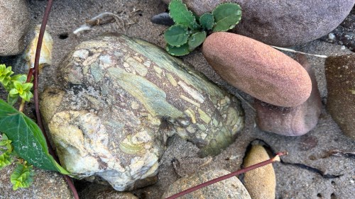
On any day without rain it’s rare to find a beach that’s not crowded but here we are at Kilgobbin Bay Beach on Dingle Peninsula. Not only did we have the place nearly to ourselves, but the beach was bordered by some of the most colorful rocks we’ve seen so far in Ireland. If we were still on the boat I’d have relocated a few choice ones to our saloon, but sadly the campervan can’t accommodate a rock collection.

We’ve grown accustomed to one-lane driving and luckily there’s little traffic in remote areas and we rarely meet someone coming head-on, but even the official Wild Atlantic Way route is also often one lane but with enough passing places to squeeze by another vehicle safely.

Still, there are areas you hope to goodness someone isn’t barreling toward you from around the bend with no passing place in evidence.

We don’t think there are nearly enough places to pull off to take photos but we take advantage of most of them. Sometimes there are food trucks or vendors or buskers. We loved this man’s music but he was selling CDs. What are you supposed to do with a CD?

We found a quiet beach parkup just before another storm blew through. Our weather has definitely improved but the squalls are still fierce and require some planning.

By morning the sun was shining again. This is the Ireland we came for.

1 Comment

Filed under Uncategorized

The Journey itself is Home

Morning found a handful of us RVers huddled together, lost in a truly massive, mostly paved parking lot. We have come to the iconic Cliffs of Moher and we are huddled together because it’s the only semi level spot in the whole damn car park.

It’s overcast, gloomy, and rainy and any thoughts of hiking are laughable at this point. The situation is that it’s quite a hike just to get to the start of the hike. Eventually we deemed it passable and we gathered our resources if not our boots and trudged up to the interesting looking visitor center.

At the cliffs the path bifurcates and we chose the path to the right, up towards O’Brian’s Tower (1835), sitting like a crown on top of the hill.

As we descended the hill we had a great view of the cliffs as they wrap around the bay to the left.

The trail constantly rises, sometimes narrow, sometimes wider, but always relentlessly climbing.

I couldn’t help but notice they had moved the trail back from the cliff edge a disconcerting dozen feet or so.

Eventually we reached what felt like the high point, although it looks like one of those Irish hikes that continue on for many more miles along the coast.

Reluctantly we headed back down.

Footsore and tired, we made it back to Escape Velocity but there was no rest for your aimless wanderers and we had just enough time to make it to our next parkup.

What a jewel awaited us at this tiny car park.

We knew there would be some sort of ruin here but I never gave it much thought, thinking it’s probably closed anyway. Yeah, I know you’re thinking this is a possible rule #2 violation (Don’t get jaded.) But the more I studied this tower the more excited I became. And as it turns out, it’s open and free to explore.

Carrigafoyle Castle was constructed by Connor Laith O’Connor in the 1490’s on a large outcropping rock at the mouth of the Shannon. It was thought of as the Guardian of the Shannon due to its strong strategic location.

Other times the owners were thought of as the taxman because of their habit of sailing out to intercept shipping on its way up to Limerick and demanding a handsome percentage of the cargo. The ships were easily spotted from the 98 foot tall tower.

The unconventional choice of using flat slabs of flagstone was because in the 1490s it was thought to be impenetrable by the conventional weapons of the time.

Technology marches on and by 1580 during the Easter siege of the castle, the Brits had the answer and used high powered cannons. They fired from the hills behind the castle and blew that fearsome hole high in the tower which collapsed the wall, crushing most of the rebels beneath. Any survivors were dispatched as per the rules.

The double arches supporting the roof are probably the only reason the tower still stands.

It takes 104 steps up the spectacular spiral staircase to reach the atrium at the top.

The view from the top reminded us that our tendency to wander with no set destination sometimes brings surprising rewards. And it’s why we coddiwomple, travel for the sheer pleasure of the journey.

2 Comments

Filed under Uncategorized

Beginnings of the Burren

Personally I wouldn’t go far out of my way to see something more stark than where I already am, but you know, in the interest of familial peace I acquiesced. Besides, somehow the navigator was guiding us right past a small pull off of great historical import. I managed to drive right past but quickly got Escape Velocity turned around and we immediately saw a nicely walled in, uh, front yard for lack of any accurate knowledge.

Wandering around through the woods we found the lintelled stone and mortared gateway to Cahermore.

Apparently it started as a medieval fort sometime between 500 to 1170 AD and by 1308 it was a wealthy family’s homestead featuring three outer stone rings around a central group of buildings.

Off in the distance in most of these photos you can see the heart of the hills of the Burren, showing the effect of multiple ice ages that shaved clean the hills leaving naked rock. And that’s where we’re headed.

The Burren is a unique glaciokarst landscape designated a UNESCO Geopark. If you want to know about the geological and human history of the region you can read more here or here.

We’d been winding our way uphill but now the climb into the mountains started in earnest. Finally we broached the tree line and found a place to spend the night here on the side of the mountain. Just us and the rocks.

It’s a little nippy up here and without much to stop it, the wind is unrelenting.

After a cold and bumpy night we headed out with purpose. Our mission is a visit to Poulnabrone-The Portal Tomb, where it’s been known to get quite crowded so we thought a morning arrival would be best. We found lots of other rock fans but it’s a large site and it can absorb lots of funseekers.

Built on top of an oval shaped cairn of loose stone, the tomb was begun in the Neolithic period some time around 4200 BC. When it was first excavated in 1986 the remains of 33 people were found interred here.

We just heard two tour buses pull into the parking lot so that makes it about time to go.

Our parkup tonight will be a commercial affair that we’re not entirely sure we’re even allowed into, but what would it be if you didn’t try? You have to try.

2 Comments

Filed under Uncategorized