Daily Archives: September 30, 2012

Land of the Aluminum Forest

We woke to a gorgeous morning on the Magothy River, tucked behind Dobbin Island. Sunny but cold.

20120930-195436.jpg
One by one the sailing yachts upped anchor and lazily turned and left. We were not the first, nor were we the last to go but we knew where they were all headed. Just like us they where all on our yearly pilgrimage to the land of aluminum forests. Annapolis.

20120930-201126.jpg
One of my favorite sailing memories happened here after a boisterous sail down the Chesapeake the wind began to die along with sun and we ghosted under the Chesapeake Bay Bridge as the sky turned beautiful shades of lilac and purple. The whole crew came out on deck and stood there in awe without saying a word.

20120930-202150.jpg
After passing under the Bay Bridge I called Marce out to the cockpit and told her that this was the spot in the Bay where we were married. You can find it too. Draw a line from the water tank across from the three towers and where it intersects with the center of the bridge is where the deed was done.

The approach to Back Creek is tricky but we knew finding anchoring space would be a lot harder.

20120930-202826.jpg
They have rules about anchoring here and they’re not afraid to kick you out of a spot that may be pushing the envelope a bit. We may have pushed a bit too much but after four tries we seem to have found a temporary home in our home port.

20120930-204905.jpg
And that’s the view from the back porch.

1 Comment

Filed under Uncategorized

Twenty-two years

Jack just called me out to the cockpit and planted a big wet kiss on me. “This is where we got married,” he said. I looked around. The Bay Bridge, the tower, the tank, yep, this is the spot. We were under sail on a chartered sailboat named Franya.

20120930-101056.jpg

“I’d do it all again,” Jack said. Me too.

5 Comments

Filed under Uncategorized

Things that go bump in the night

A tour de force was delivered by the navigation staff. We were a little…lets just say optimistic about what Escape Velocity could do fighting a knot and a third contrary current up the Delaware Bay. It was our fourth trip up the buggy bay so you figure you’ve got it sussed out but, well you know, we were impatient and thought we’d P.O.R. (Press on regardless.) So we left a few hours early and the plan was to let the changing tide catch up to us. It never did. I will say that it was my first trip up the bay without a south breeze, which can make you forget all about that damn current.

We saw very few ships until dusk, and then it was like elephants in a circus parade, trunk to tail. After the last bay run we swore off the Delaware Bay at night, but that was when we used paper charts and you just can’t get more confused than running Delaware Bay at night using charts.

We had that sinking feeling when it became obvious that we weren’t getting anywhere near our goal of halfway through the canal. Marce found a great anchorage behind Reedy Island, just before the canal entrance. The only catch was that the narrow channel was barely marked, and at night it would be tough. Once all the clues lined up we threaded our way into the back channel of Reedy Island and we were suprised to find six other sailboats already there.
We crawled into bed ready for an undisturbed nights rest due to the fact that the current in the canal didn’t become fair until 10am.

Marce woke me up asking me,” what was that”? I said that I didn’t hear anything, which is what I always say. Then I heard it. It was a heavy thump. I was out of bed like a shot. I knew the other boats were spaced far apart so I couldn’t imagine what was going on. Halfway to the foredeck I realized that I wasn’t dressed and it was cold and misty. There in the beam of my flashlight was a ten foot long log about a foot and a half in diameter caught sideways on the bridle, chain, and spinning like a waterwheel in the very strong current that finally caught up to us! It was all I could do to push it enough with a boat hook to send it on its way. Marce was sound asleep when I shivered my way back under the covers.

Saturday morning had a relaxed pace to it, even though we really needed to get going, we weren’t about to make the same mistake twice and the current wouldn’t be with us until about 10am. About 9:30 I went out on deck to lift the anchor and noticed all the other boats had started to up anchor too. Funny how that works.

20120929-230041.jpg
Leaving Reedy Island we noticed dodgy weather ahead but as soon as we were in the canal we were doing 8.2kts. and thoughts of Annapolis sprang into our heads. I thought we might actually pull it off.

It was a strange trip through the canal. First we noticed how built up it’s become. Like your dad always said, while driving through some neighborhood that all this used to be farm land…well it did. Some crazy guy pushing an equipment barge at a self confessed 25 knots threw up the worst wake I’ve ever seen with huge rollers for miles behind him, causing much grief for all the boats around us. Then, in a scene straight out of The Wild One, we were harassed by dozens of guys on Skidoos! I kid you not!

20120929-232004.jpg
This canal is a heartbreaker in that it has several false bays as you near the end so that as you clear one bay only to realize that you’ve got another to go, and it goes on and on like that. Finally we broke out into the Chesapeake Bay with a spot of motorsailing.

20120929-232843.jpg
We began to have that sinking feeling again. We weren’t going to make Annapolis but we would be close.

Anchor down at 7pm as the sun sets over beautiful Magothy River.

20120929-233249.jpg
Marce made an incredible pizza for dinner

20120930-073854.jpg
As we were sitting around watching an old Newsroom episode, thanks to who ever had that fast WIFI signal, Marce looked up at me and said, “What was that?” Of course I said I didn’t hear anything, but then we both heard boom boom boom, and as we stepped out of the cockpit we were treated to a great enthusiastic fireworks display. Not municipal, but so much fun. I like fireworks. When it was over all the boats anchored behind Dobbin Island tooted their horns in appreciation.

Tomorrow Annapolis!

20120930-094250.jpg

Leave a Comment

Filed under Uncategorized

Thirteen years and a different world

In 1999 we met two sailors at a First Aid for Boaters course in Pittsburgh and hit it off immediately. Within weeks they invited Jack and me to sail from Annapolis to Martha’s Vineyard and back. In retrospect we didn’t know the boat, we didn’t know the sailors’ experience or knowledge, and for that matter they could have been ax murderers. But Stan and Jim were smart, funny and generally up for anything. We said yes without hesitation.

It was our first passage and our first night sailing. We left Annapolis early on a Sunday morning and sailed up the Chesapeake all day, then motored through the C&D canal as the sun was going down. We would do two-man watches; I was paired with Jim, Jack and Stan would take the first watch. As we left the canal Jim and I went down below to try to sleep.

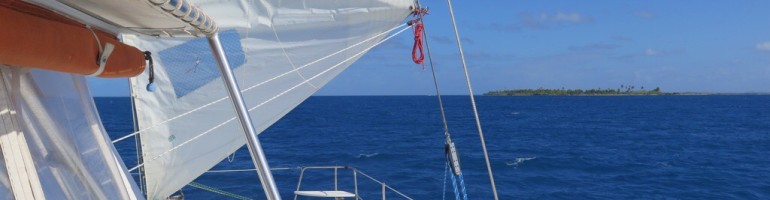
Jack loves to sail. He sails the wind. Sometimes it’s hard to convince him that cruising under sail is a little different in that you have to sail a course in order to get somewhere. But he excitedly took the helm in the dark and tacked upwind back and forth across the river while Stan checked the chart to make sure the way was clear. That’s when we discovered that the Delaware River is littered with unlighted navigational markers. For as many red and green lights as you see on a night passage, there are as many nuns and cans with no lights. Tacking back and forth across the channel was maybe not the prudent course, and there were a few close calls where Jim and I were awakened by Jack shouting “Tacking!” then tossed out of our berths as he quickly turned the wheel to avoid some obstacle or another.

When Jim and I took over a few hours later we learned that you have to sail closer to a marker and shine a light on it to read the number before confirming your position on the chart, which you looked at using a red flashlight because a white light will screw up your night vision.

The Delaware River, before it widens into the bay, is so confusing at night, with lights ashore competing with nav lights, that most sailing directions recommend against making the passage at night. Somehow we made it unscathed and by dawn we were within sight of Cape May. It was an exhilarating — if frightening — first overnight passage.

But we didn’t learn our lesson. On the way back we once again did the Delaware Bay and Delaware River at night. And once again the shore lights competing with the nav lights made the Delaware River confusing and scary. GPS was just becoming widely available and early-adopter Stan had a handheld unit, but all it told you was your latitude and longitude, which you could then plot on the paper chart. If it was correct, which it often wasn’t because of so-called “dithering,” the apparent attempt by the military to make consumer GPS less accurate for national security purposes.

So with no help from GPS, we made our way old school up the river from buoy to buoy, and we succeeded by luck and diligence to get the boat safely back to Annapolis again.

We count that trip as one of the milestones for us in our journey from Gettysburg Street to Escape Velocity. We probably made every mistake in the book but learned from nearly all of them.

I say nearly. Thirteen years later we came up the Delaware River in the dark. But oh, what a difference a decade makes!

We now have a chartplotter, an electronic representation of the classic navigational charts with our position plotted — now accurately — by GPS. But even better is the iPad, with newer, less cluttered and easier to read electronic charts.

We decided to anchor for the night just before the entrance to the canal behind a little island. Our cruising guide recommended sailing to a particular marker, then following a set course to the very narrow passage between two shoals into the anchorage. Here’s what the electronic version of the traditional chart of the area looks like.

20120930-080630.jpg
This is on the iPad, but imagine peering at it on paper with a red flashlight in the dark and trying to make out where to go, plotting with compass and ruler.

Here’s the iPad Navionics version. The bold yellow line is our track.

20120930-080838.jpg

I didn’t photograph the chartplotter version because it’s only slightly less confusing than the traditional chart, except that it does plot our position on it. But in tight squeezes like this one? It’s iPad all the way. We easily found the passage, motored to the right place and dropped the hook, all in the dark.

It’s so much better now!

1 Comment

Filed under Uncategorized